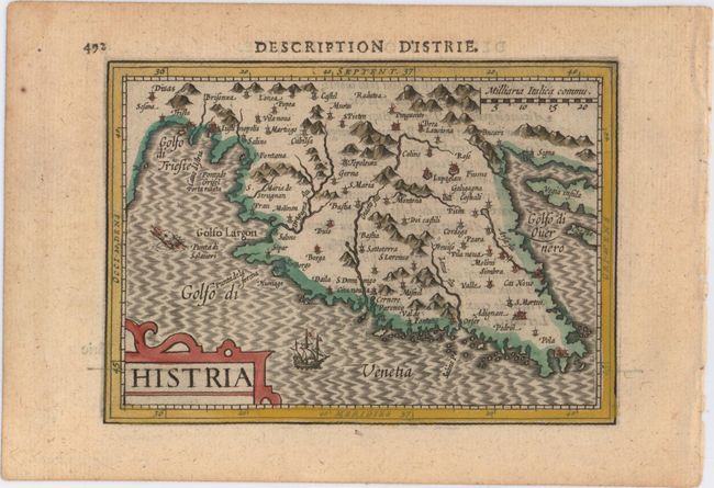
Subject: Istria
Period: 1618 (published)
Publication: Tabularum Geographicarum Contractarum…
Color: Hand Color
Size:
5.4 x 3.8 inches
13.7 x 9.7 cm
This handsome miniature map depicts the historic region of Histria, the largest peninsula in the Adriatic Sea, and now primarily part of Croatia. The map extends north to include Trieste, Italy and east to include a portion of the islands of Krk and Cres. The map is handsomely adorned with a sea monster, a sailing galleon, a moiré-patterned sea, and a strapwork title cartouche. French text on verso.
References: King (2nd ed.) pp. 96-99; Van der Krogt (Vol. III) #7180:342.
Condition: A
A crisp impression with attractive color and a minor damp stain in top left corner, away from image.