Catalog Archive
Auction 151, Lot 546
Detailed Map of Crimea and Regions Surrounding Black Sea
"Nouvelle Carte de la Petite Tartarie et la Mer Noire, Montrant les Frontieres de l'Imperatrice de Russie, et l'Empereur des Turcs...", Delisle, Guillaume
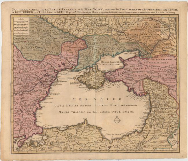
Subject: Black Sea
Period: 1730 (circa)
Publication:
Color: Hand Color
Size:
23.3 x 19.1 inches
59.2 x 48.5 cm
Download High Resolution Image
(or just click on image to launch the Zoom viewer)
(or just click on image to launch the Zoom viewer)