Subject: Western Europe
Period: 1914 (published)
Publication:
Color: Printed Color
Size:
26.8 x 23.6 inches
68.1 x 59.9 cm
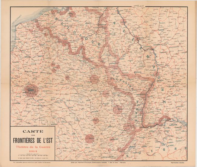
This French map was published at the outbreak of World War I and depicts France's strong-points on its "eastern frontiers." The map extends from Paris and Antwerp in the west, to Dusseldorf in the north, Stuttgart in the east, and Bern in the south. The extensive road system is shown in red, with rivers in blue and towns in green. Heavily fortified cities are circled in pink. Note that Alsace and Lorraine, lost to Germany in the Franco-Prussian War forty years earlier, is shown outside of France's borders as a rallying cry to the French patriotic fervor of the time. The map was published by Guiraud in Marseille.
References:
Condition: B+
Issued folding with light toning and a few tiny holes and separations along the folds.