Subject: Low Countries
Period: 1737 (dated)
Publication: Atlas ou Recueil de Cartes Geographiques…
Color: Hand Color
Size:
24.1 x 18.2 inches
61.2 x 46.2 cm
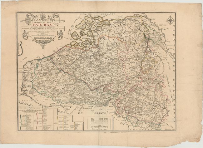
This rare map of the Low Countries includes great detail of towns, rivers, and the topography of the land. The political boundaries are drawn according to the Treaties of Utrecht, Rastatt and Antwerp (also known as the Barrier Treaty) between 1713 and 1715. A table at bottom left identifies the provinces possessed by the French, Austrians, Prussians and United Provinces as dictated by the treaties. The decorative title cartouche features the coasts of arms of the French, Austrians, Brandenburg and the United Provinces (Etats Generaux). Engraved by P. Starckman.
References: Pastoureau, Fer II D [39].
Condition: B
Watermarked paper with a couple of tiny tears along the centerfold and at left. There is a printer's crease at right as well as several extraneous creases.