Subject: Low Countries
Period: 1609 (circa)
Publication: Theatrum Orbis Terrarum
Color: Black & White
Size:
21.9 x 16.3 inches
55.6 x 41.4 cm
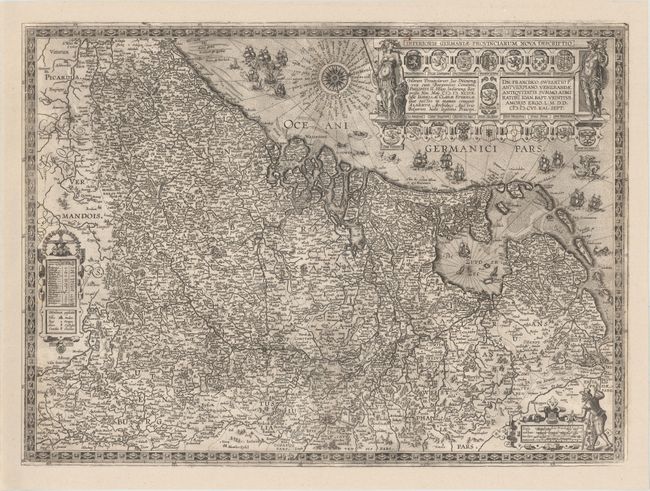
This handsome and decorative map of the Low Countries was first published in the 1608 edition of the Theatrum, and only appeared in 5 subsequent editions. The map extends from the Waddeneilanden in the north to Calais, France in the south, and as far east as Dusseldorf and Trier, Germany. The map is densely engraved with towns, rivers, and political boundaries, however the numerous embellishments are what draw the eye. A strapwork distance scale at bottom features a cartographer with measuring dividers, and another strapwork cartouche at left provides a legend. The elaborate title cartouche is flanked by Minerva and Mercury and surrounded by 17 coats of arms. The North Sea and Ijsselmeer are filled with ships (some engaged in battle), sea monsters, and Neptune riding a hippocampus. This is the second state, with only Latin text in the title cartouche. Latin text on verso, published between 1609-12. Van den Broecke estimates that only 300 copies of this edition were printed, and only 1050 of all editions combined.
References: Van den Broecke #59.2.
Condition: B+
A nice impression on watermarked paper with light printer's ink residue. There are two professionally repaired tears in image near centerfold, each less than 1" in length. Expertly remargined on all sides, with neatline at left and a portion of the numbers of latitude (also at left) replaced in facsimile.