Subject: London, England
Period: 1854 (circa)
Publication:
Color: Hand Color
Size:
35.5 x 19.1 inches
90.2 x 48.5 cm
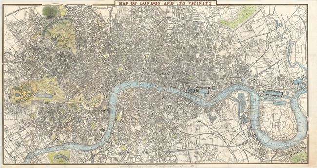
This magnificent map of London centers on the River Thames and spans from Kensington Palace and Hyde Park to the East India Docks and Greenwich Park. It is filled with detail, showing boroughs, streets, parks, railways, canals, docks, gardens, and more. Among the sites of interest located are St. Paul's Cathedral, the Houses of Parliament, Westminster Abbey, the site of the Great Exhibition of 1851, London Bridge, and Buckingham Palace (here called The Queen's Palace).
References:
Condition: B
A nice impression issued folding with numerous fold separations that have been closed on verso with archival tape, light offsetting, and one small chip at top and a few short edge tears. The top margin has been trimmed to the neatline above the title.