Subject: Buenos Aires, Argentina
Period: 1809 (circa)
Publication: Voyages dans l'Amerique Meridionale
Color: Hand Color
Size:
18.4 x 10.3 inches
46.7 x 26.2 cm
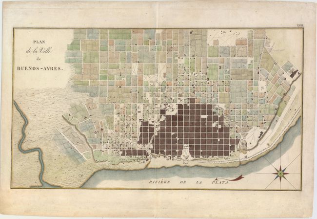
This fine copper-engraved plan of Buenos Aires and the surrounding countryside is laid out in blocks with unnamed streets. The fort and Grande Place are prominently shown on the coast with the fort's ramparts well delineated. Embellished with large compass in the bay. The plan is from De Azara's important narrative of the discovery and conquest of Paraguay and the Plata River. De Azara went to South America in 1781 as one of the commissioners to settle the boundary between the Spanish and Portuguese possessions. He remained there for twenty years and became an authority on both the natural and political history of the region. De Azara's maps are filled with exceptional detail, not found on any other maps of this period.
References:
Condition: A
Attractive color with one small hole that has been archivally repaired.