Subject: Brazil
Period: 1671 (circa)
Publication: De Nieuwe en Onbekende Weereld
Color: Hand Color
Size:
14.2 x 11.5 inches
36.1 x 29.2 cm
Montanus' work was perhaps the greatest illustrated book on the New World produced in the seventeenth century. It contained over one hundred beautifully engraved plates, views, and maps of North and South America. The plates vividly depict forts, festivals, occupations, Dutch fleets, battles, religious rites, and customs of the native inhabitants. This important work was translated into German by Olivier Dapper, and into English by John Ogilby. Several of the plates were later acquired by Pierre Vander Aa.
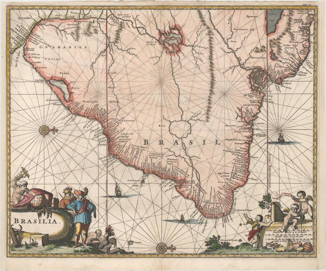
Excellent map of the eastern part of Brazil based on the cartography of Hessel Gerritsz and an earlier map by Blaeu. There is extensive detail in the coastal regions with the interior left largely blank except for some conjectural river systems, including the mythical Parime Lago in Guiana and Xarayes Lago in Brazil. The Linea Aequinoctialis is prominently shown dividing the Spanish and Portuguese colonial claims. Richly embellished with rhumb lines, compass roses and sailing ships. European traders, Indians and putti surround the title and scale of miles cartouches.
References:
Condition: B+
A dark impression with attractive color on watermarked paper. There are professional repairs to a few small worm holes and a centerfold separation confined to bottom blank margin. The side margins have been extended to accommodate framing.