Subject: Gulf of Mexico & Caribbean
Period: 1659 (published)
Publication: De Zee-Atlas oft Water-Waereld
Color: Hand Color
Size:
21.5 x 17.2 inches
54.6 x 43.7 cm
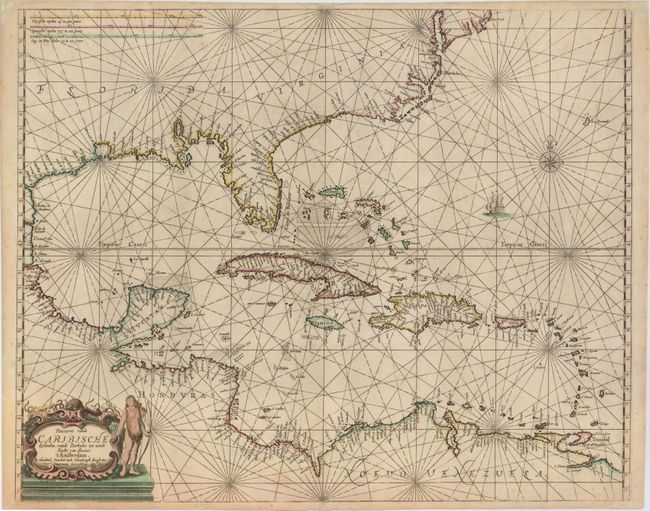
This is the rare first state of Doncker's chart of the West Indies. It extends to show the coastline of North America nearly to New England, all of Central America, and the northern coastline of South America. The chart was derived from Hessel Gerritsz' chart circa 1631, particularly in the depiction of Florida and the Caribbean islands. Doncker's map, however, extends a bit further north, and shows the south-east coast of the United States shifted much further to the east. In addition, Doncker's chart presents a more prominent R. d. S. Petro with an exaggerated Apalachee Bay. There is a wealth of navigational information including passages, anchorages, sandbanks and shoals, and hundreds of place names fill the coasts. The chart is embellished with a sailing vessel, a compass rose, and an elegant strapwork title cartouche featuring a Native American figure.
References: Burden #339.
Condition: A
A strong impression with a couple of very faint spots and several professional repairs to minor chips and tears in blank margins.