Subject: Gulf of Mexico & Caribbean
Period: 1598 (circa)
Publication: Theatrum Orbis Terrarum
Color: Hand Color
Size:
19.5 x 13.9 inches
49.5 x 35.3 cm
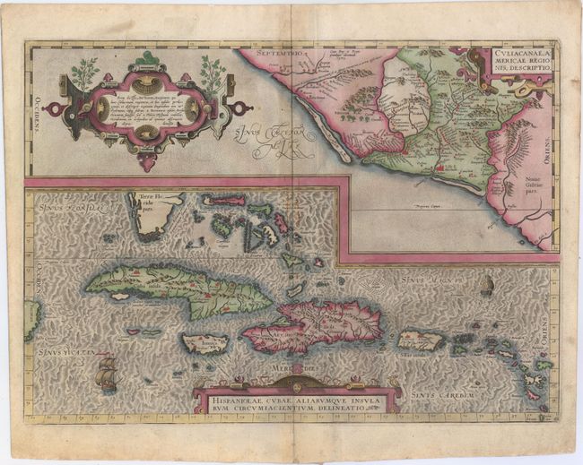
Two great early maps of important regions in the New World are combined into this interesting composition. The first covers the region of western Mexico around Culiacan and the Spanish settlement of Villa S. Michael's, the region noted for its silver mines. The second is the first detailed map of the Greater Antilles with detail in southern Florida, the Bahamas, and the Caribbean that is quite remarkable for the period. Ortelius based the maps on a variety of sources including Mercator’s world map (1569) and other maps by Guttierez and Alonso De Santa Cruz. Three strapwork cartouches and sailing ships decorate the map. Dutch text on verso with page number 8, published between 1598-1613.
References: Van den Broecke #14.
Condition: B+
Lovely original color on watermarked paper with a hint of toning along centerfold and a few small stains near center of map.