Subject: Western United States & Mexico, Texas
Period: 1832 (dated)
Publication: The London Atlas of Universal Geography
Color: Hand Color
Size:
23.7 x 19.1 inches
60.2 x 48.5 cm
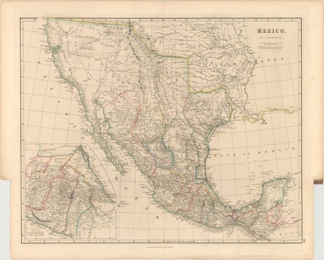
This is the first edition of Arrowsmith's folio-sized map of southwestern United States, Texas and Mexico, and was published four years prior to Texas gaining independence from Mexico. In Upr. or New California, there is an American Fur Co. Depot on the eastern shore of Youta or Gt. Salt L.. The Great Spanish Road is shown extending from the Red River on the US-Mexico boundary and past Santa Fe to Nutrias. A note through present-day New Mexico states that the area is "frequented by roving bands of Indians who roam about in the quest of game." A large inset depicts central Mexico, centered on Mexico City and showing the important ports of Acapulco, Vera Cruz and Tampico.
References:
Condition: A
Original color on sturdy paper with a few tiny, unobtrusive spots.