Catalog Archive
Auction 151, Lot 327

"Carte de la Californie d'Apres les Observations le Plus Exactes, pour Servir a l'Histoire Generale des Voyages", Prevost, Anton Francois

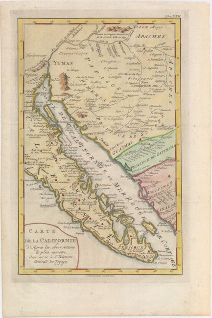
Subject: Southwestern United States & Mexico

Period: 1777 (dated)

Publication: L'Histoire Generale des Voyages

Color: Hand Color

Size:
7.9 x 12.4 inches
20.1 x 31.5 cm
Download High Resolution Image
(or just click on image to launch the Zoom viewer)

This is a French version of Venegas' significant map showing most of the Baja peninsula, northwest Mexico and what will become the southern portion of Arizona. Originated in 1757, it expands on the exploration of the region by Father Kino. It presents, in great detail, the Gila River region, the missions and Indian towns of the Pimeria Alta and Baja California. Engraved by A. van Krevelt.

References: Lowery #591; cf. Wheat (TMW) #138.

Condition: A+

A nice dark impression with attractive color and wide margins. Near mint.

Estimate: $375 - $450

Unsold

Closed on 11/19/2014

Archived