Subject: Vermont
Period: 1795 (circa)
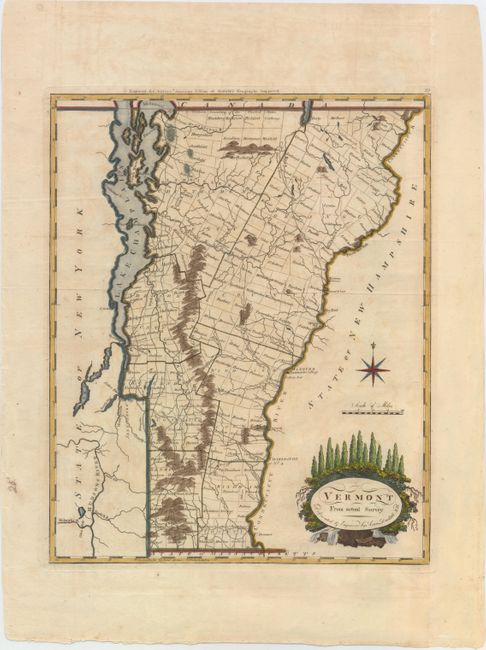
Publication: Carey's American Edition of Guthrie's Geography Improved...
Color: Hand Color
Size:
11.9 x 14.7 inches
30.2 x 37.3 cm
Mathew Carey was a seminal figure in early American publishing; establishing the first publishing firm to specialize in cartography and issuing the first atlas devoted exclusively to American maps. He set up an elaborate cottage system of craftsmen for compiling, engraving, printing, and coloring maps. This practice was emulated by later American cartographic publishers such as John Melish and Henry S. Tanner. The American Atlas concept was also adopted by other publishers in both the United States and Europe.
This early map of Vermont is the second edition as evidenced by "Engraved for Carey's American Edition of Guthrie's Geography Improved" above the neatline and the number 25 at upper right. It is divided into seven counties with townships shown and named. The major towns, Dartmouth College, and a fairly extensive road network is delineated. Engraved by Amos Doolittle, a New Hampshire cartographer and engraver who produced many of the best early maps of New England. This map of Vermont is a fine example of his work.
References: Wheat & Brun #195.
Condition: B+
A nice impression on watermarked paper with wide margins, a couple of light creases, and faint offsetting.