Subject: Texas
Period: 1856-60 (dated)
Publication:
Color: Hand Color
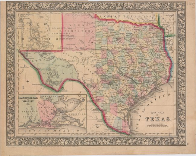
A. County Map of Texas, by Samuel Augustus Mitchell Jr., dated 1860 (13.5 x 10.8"). One of the most attractive maps of the state of Texas, inset with a map of Galveston Bay, and Vicinity. West Texas is made up of Young Territory, Bexar Territory, El Paso and Presidio counties, and clearly shows the Llano Estacado or Staked Plain with a notation about the region being "destitu[t]e of both wood and water." Erath County is mistakenly identified as "Earth" County. The map shows trails, roads, a limited railroad system that extends only into Austin, and proposed railroads indicated by dashed lines. The map is surrounded by a fine floral border. Copyright date 1860, published circa 1864. The county development is up-to-date for 1864 as Dawson County, abolished in 1866, is included. Condition: Light toning with a narrow top margin, a faint damp stain at bottom right, and a crease at top right.
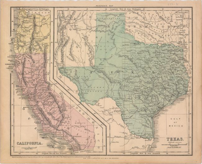
B. Texas [on sheet with] California, by S.S. Cornell, dated 1856 (12.8 x 10.1"). This map was published in Cornell's High School Geography... and shows both Texas and California on one sheet. West Texas is composed of El Paso and Presidio counties and Bexar Territory. Development is confined to the eastern portion of the state. Shows "Laredo Road" and "Route to Ft. Smith." Published by D. Appleton & Company. Condition: There are a few edge tears including one that extends 1" into the image at left, which have been closed on verso with archival tape.
References:
Condition: B+
See description above.