Subject: Eastern Hemisphere
Period: 1798 (circa)
Publication:
Color: Black & White
Size:
24.1 x 14.8 inches
61.2 x 37.6 cm
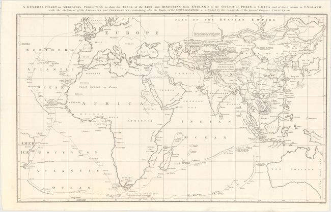
This is a reduced version of Barrow's large map from An Authentic Account of an Embassy from the King of Great Britain..., an account of George Macartney's travels to China. Macartney was Britain's first envoy to China and was tasked with convincing Emperor Qianlong to ease restrictions on trade between Great Britain and China by allowing the British to have a permanent embassy in the country.
The map shows the track of two ships, the Lion and Hindostan, on their routes from England to China and back. Each day's progress was recorded along the route with several notations to the dangers along the way. Much of the area in and around China is dense with notations on the land and its peoples. The map was drawn by John Barrow, who was the private secretary to Lord Macartney. He was later Secretary to the Admiralty and was a vice-president and founding member of the Royal Geographical Society. Engraved by B. Baker.
References: cf. Shirley (BL Atlases) G.BARR-1a #1.
Condition: A
A crisp impression issued folding on a clean, bright sheet with a few tiny splits at fold intersections and a small chip at right that has been archivally reattached.