Subject: Oklahoma
Period: 1886 (published)
Publication:
Color: Printed Color
Size:
6.2 x 9.3 inches
15.7 x 23.6 cm
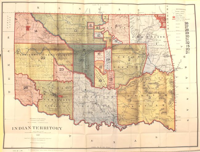
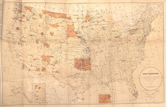
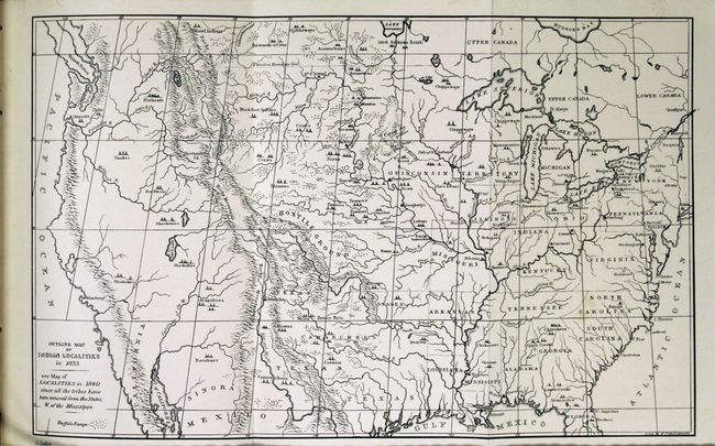
This Smithsonian report, written by Thomas Donaldson, contains the significant "George Catlin Indian Gallery", which consists of numerous plates and two large folding maps: Indian Territory (32 x 24") and Map Showing Indian Reservations within the Limits of the United States... (33 x 21"). The map of Indian Territory shows the allocation of land among 50 different Indian tribes and depicts 25 different regions, naming 7 more. A small portion of the panhandle is shown and labeled Public Lands. The map of the United States shows the network of Indian reservations primarily confined to west of the Mississippi. Includes inset maps of Indian Territory, southern California and Alaska. 939 pp., octavo, hardbound in brown cloth.
References:
Condition: A
Maps and text are clean, bright, and near fine. The United States has a very small, 0.5" binding tear. Covers and spine have light shelf wear.