Catalog Archive
Auction 151, Lot 266

"[Lot of 2] City of New-York [and] A New Map of New York with Its Canals, Roads & Distances from Place to Place Along the Stage & Steam-Boat Routes", Tanner, Henry Schenck
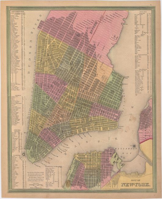
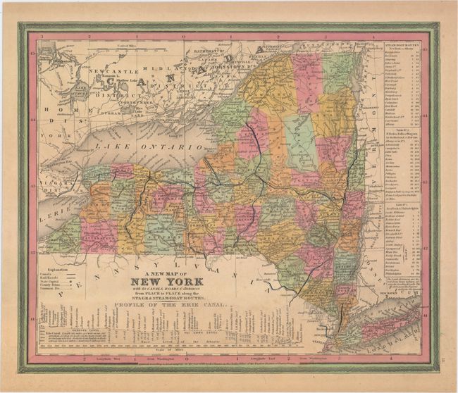
Subject: New York

Period: 1835-40 (dated)

Publication: New Universal Atlas

Color: Hand Color

Size:
See Description
Download High Resolution Image
(or just click on image to launch the Zoom viewer)

A. City of New-York, dated 1835 (12.2 x 15.3"). This detailed map of Lower Manhattan extends to 37th street. The city is divided into wards with an index at left and right to public buildings, hotels and churches.

B. A New Map of New York with Its Canals, Roads & Distances from Place to Place Along the Stage & Steam-Boat Routes, dated 1840 (13.6 x 11.3"). Handsome map of the state showing counties, roads, railroads, canals and towns. A profile of the Erie Canal appears below the title. At right are 3 tables detailing the steamboat routes from New York to Albany, New York to Niagara Falls and New York to Philadelphia.

References:

Condition: B+

Original color with minor soiling and light toning along edges of sheet.

Estimate: $250 - $325

Sold for: $180

Closed on 11/19/2014

Archived