Subject: Nantucket, Massachusetts
Period: 1852 (published)
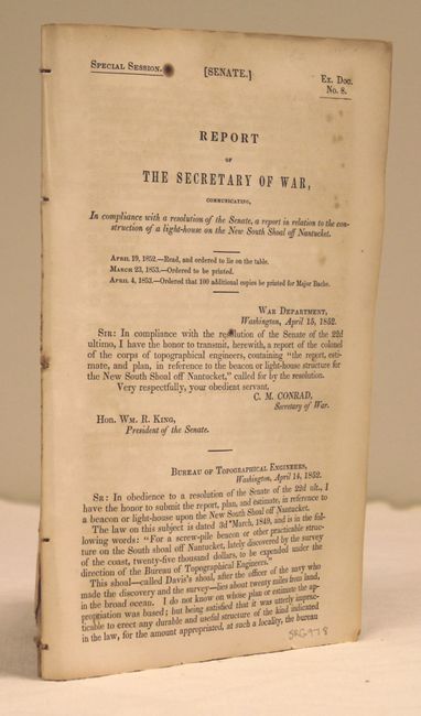
Publication: Sen Ex. Doc No. 8, Special Session
Color: Black & White
Size:
5.8 x 9.1 inches
14.7 x 23.1 cm
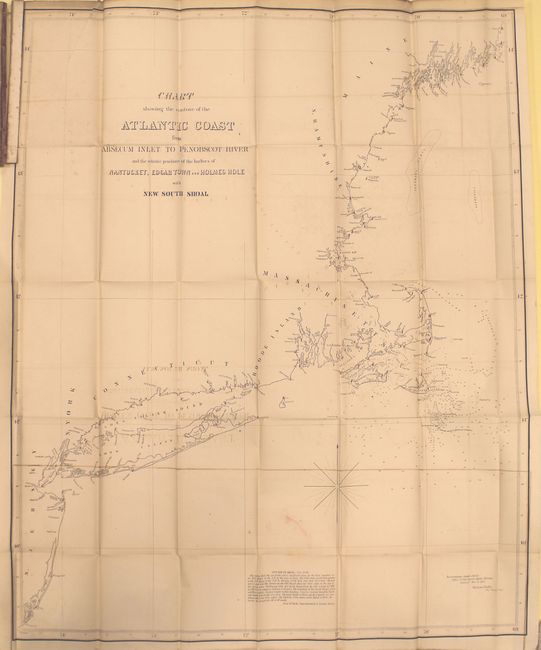
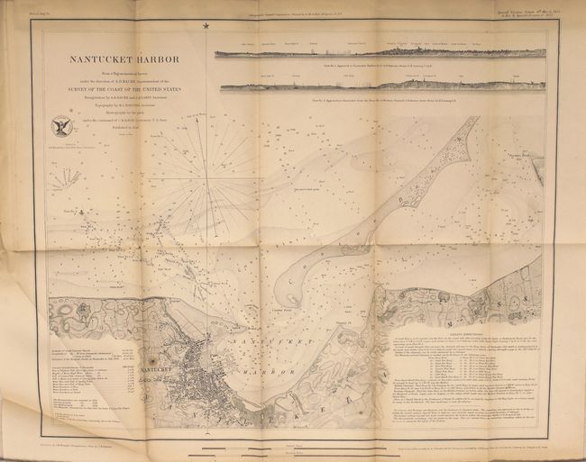
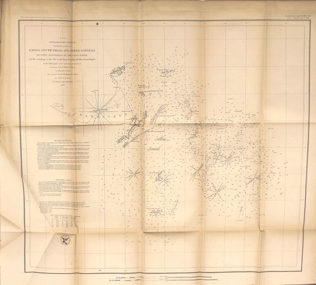
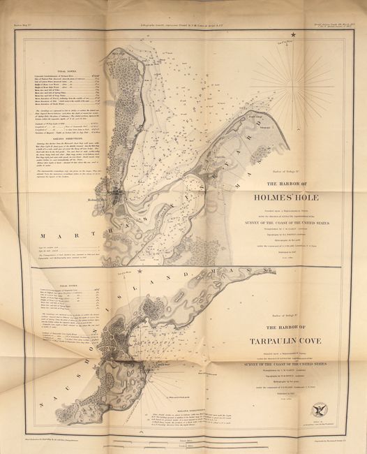
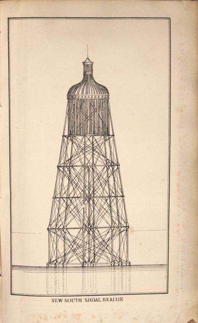
This report provides an interesting and detailed discussion of proposed lighthouse plans for a then recently discovered navigation hazard, named Davis's Shoal, located about 20 miles off the coast of Nantucket. The maps are among the earliest US Coast Survey maps of the region, including finely detailed harbor maps for Nantucket, Edgartown, and Holmes Hole/Tarpaulin Cove:
A. The Harbor of Holmes Hole [on sheet with] The Harbor of Tarpaulin Cove (14 x 17.5")
B. Preliminary Sketch Showing the Positions of Davis's South Shoal and Other Dangers (19 x 16 .8")
C. Nantucket Harbor (17.3 x 14")
D. Edgartown Harbor (14 x 17.5")
E. Map Showing the Proposed Site for Lighthouse or Beacon on New South Shoal (16 x 18.5")
F. Chart Showing the Contour of the Atlantic Coast from Absecum Inlet to Penobscot River and the Relative Positions of the Harbors of Nantucket, Edgartown and Holmes Hole with New South Shoal (26.5" x 33)
Disbound, 59 pp. of text with 4 plates and 6 folding maps.
References:
Condition: B
The maps are good to very good with light toning along the folds and a few spots of foxing. The large map of the Atlantic coast has a short binding tear. Disbound text has scattered foxing.