Subject: Maine
Period: 1793-1811 (circa)
Publication:
Color: Black & White
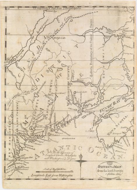
A. The District of Main from the Latest Surveys, by Jedidiah Morse, from Morse's American Universal Geography, published 1793 (8.0 x 10.6"). This scarce and finely engraved map from the American Universal Geography is considered the first obtainable map that focuses on Maine. The northwest boundary with Canada has the notation "High Lands Being the Boundaries between the United States and Canada." This gives a northern border further north than that which was eventually decided. Only four counties are noted and Moosehead Lake is misspelled Mousehead Lake. Longitude is measured east from Washington and Philadelphia. This early edition varies from later Morse issues with finer engraving, a notation to the left of the compass rose, the title contained in an oval cartouche, and no outer neatline. Condition: Issued folding with light soiling and a printer's crease near the top neatline.
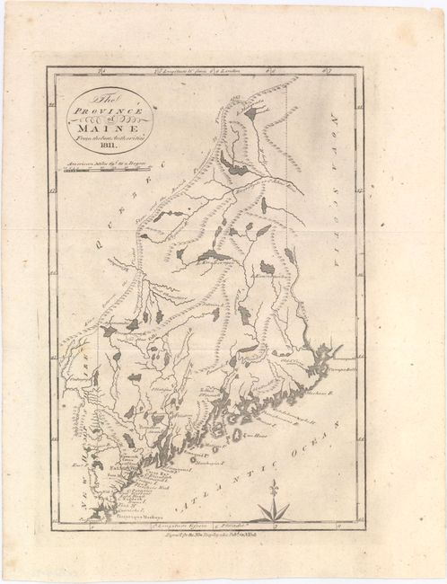
B. The Province of Maine from the Best Authorities, by E. Low, for Low's New Encyclopaedia, dated 1811 (7.3 x 10.6"). This is a reduced version of Samuel Lewis' map of 1794. It contains early information on the coastline, watershed and topography. Settlement is limited to the extreme southwest with a wagon road connecting York, Falmouth, Portland, Casco, Yarmouth, and extending perhaps as far as Fort Western. The frontier forts of Pownal and Halifax are noted. The northern boundary is per the Treaty of 1783. Condition: Issued folding with just a few faint spots and a tiny hole near the St. Croix River.
References: Wheat & Brun #168.
Condition: B+
See description above.