Subject: Florida
Period: 1856-59 (circa)
Publication:
Color:
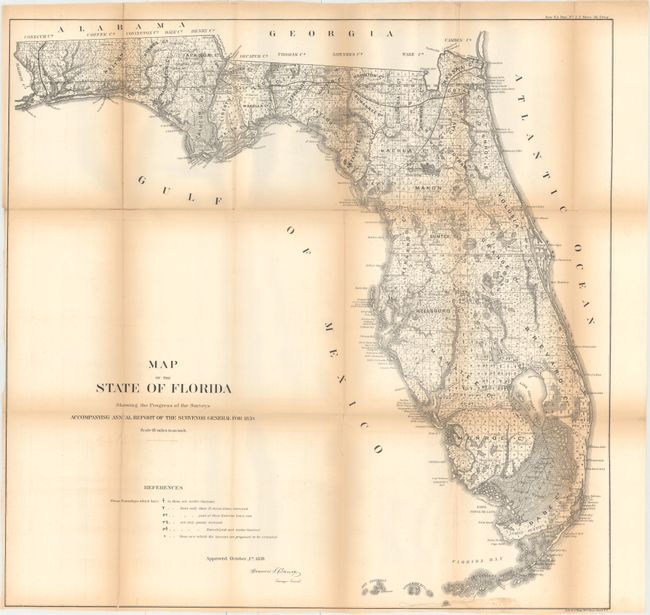
A. Map of the State of Florida Showing the Progress of the Surveys Accompanying Annual Report of the Surveyor General for 1859, by U.S. State Surveys, from Sen: Ex: Doc. No. 2, 1st Sess., 36th Cong., dated 1859, black & white (24.1 x 23.6"). This state survey map is drawn on a scale of 18 miles to the inch. It shows the topography, vegetation, towns, cities, forts, rivers, lakes, swamps and many early trails and roads. Most of the state is shown as surveyed with a key designating the extent or the work completed. Area extends to show the keys and to Dry Tortugas Island and Ft. Jefferson, and locates Ft. Lauderdale, Boca Rabones, Key Biscayne and scores of smaller keys. It is signed in the plate by Francis L. Darcy, Surveyor General. Condition: Issued folding with several fold separations that have been mostly closed on verso with archival tape and moderate toning along the folds.
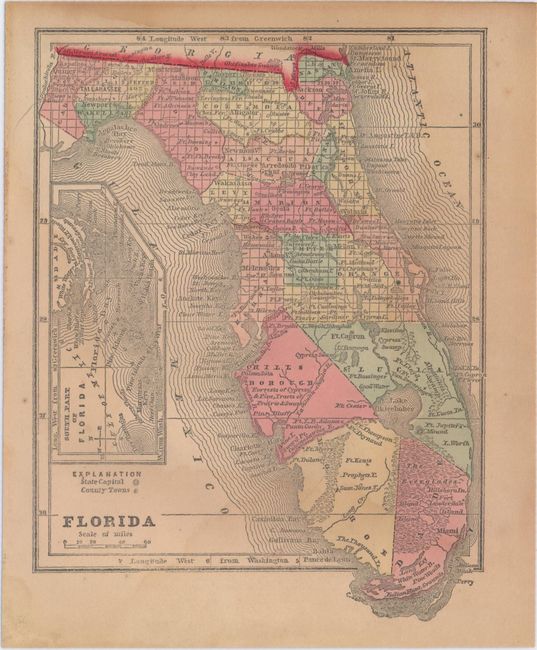
B. Florida, by Morse & Gaston, circa 1856, hand color (5.0 x 6.7"). This small map of Florida was published in The Diamond Atlas. Despite being issued only a few years before the above map, surveying had only reached as far south as Tampa. Condition: Light toning with faint damp stains.
References:
Condition: B
See description above.