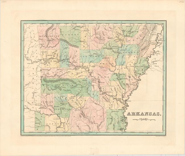
Subject: Arkansas
Period: 1838 (dated)
Publication: An Illustrated Atlas, Geological, Statistical, and Historical…
Color: Hand Color
Size:
14.4 x 11.3 inches
36.6 x 28.7 cm
This copper engraved map was made two years after Arkansas became a state. County development is circa 1835 as several 1836 changes are not on the map; Miller is shown in the southwest, and Washington has not yet lost territory to Madison and Benton counties. The map shows good topographical, geographical, and political detail. All the counties are individually hand colored. Part of Missouri Territory is shown but not hand colored. Not a single railroad line is located in this early statehood map. Engraved by G.W. Boynton and published in Boston by Weeks, Jordan & Co.
References:
Condition: A+
A dark impression on a sturdy sheet.