Subject: Central United States
Period: 1832-76 (circa)
Publication:
Color:
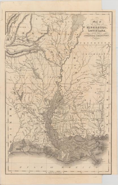
A. Map of the States of Mississippi, Louisiana, and the Arkansas Territory, by John Hinton, dated 1832, black & white (10.5 x 16.1"). A very detailed map showing Indian tribes, parishes, rivers, forts and roads. The map extends to the Sabine River with Mexico to the west. Arkansas Territory, with early county development, is included. The Mississippi Delta area is especially well-rendered, graphically depicting the swamps. Topography is shown via bold hachure and swamps and wetlands are depicted with shading. Condition: Issued folding with light offsetting and toning, as well as binding trims at the top and bottom right corners of the sheet. (B+)
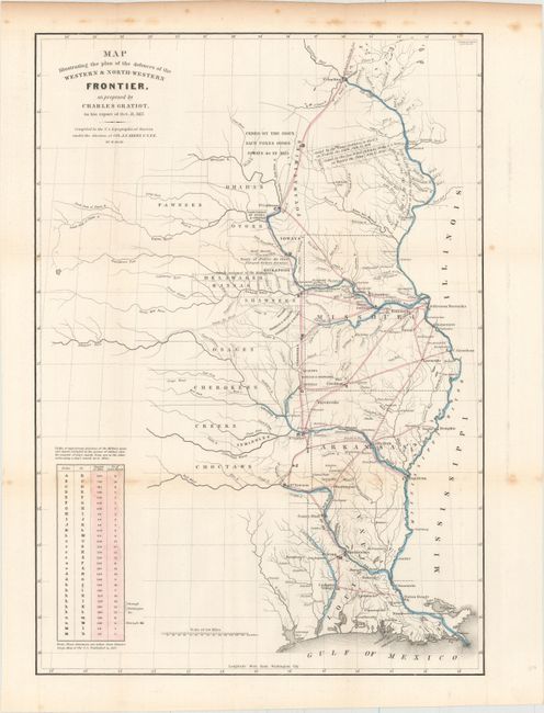
B. Map Illustrating the Plan of the Defences of the Western & North-Western Frontier..., by Charles Gratiot, from Sen Doc. 65, 25th Congress, 2nd Session, circa 1838, hand color (15.3 x 21.6"). This map is from the series of maps that illustrated the factious Congressional debate over the nature of the frontier defenses in the region between the Mississippi River and the Rocky Mountains. Issued under the direction of Col. J. J. Abert by W. Hood, the map depicts the states of Missouri, Arkansas, Louisiana and the Indian nations bordering them to the west. It shows the locations of many military forts and outposts from Ft. Jessup to Ft. Snelling with notations throughout concerning lands ceded by several Indian nations with the dates of the treaties. The threat posed by hostile Indians, whose numbers greatly exceeded those of the area's settlers, resulted in a protracted Congressional debate concerning the defenses required along the frontier. A table at lower left notes the distances between forts and the equivalent "days of march" at 15 miles per day. Ref: Wheat (TMW) #427; Claussen & Friis #183. Condition: Issued folding with some minor foxing primarily along one fold and in the upper blank margin. (B+)
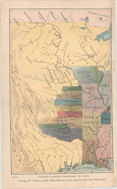
C. U. States' Indian Frontier in 1840, Shewing the Positions of the Tribes That Have Been Removed West of the Missisippi, by George Catlin, circa 1876, printed color (5.4 x 8.6"). Shows the location of over twenty Indian tribes from present-day Oklahoma to Iowa that were displaced by western expansion. Condition: (A)
References:
Condition:
See description above.