Subject: Louisiana, Arkansas
Period: 1839-41 (dated)
Publication: New Universal Atlas
Color: Hand Color
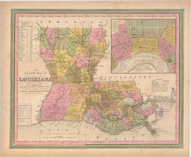
A. A New Map of Louisiana with Its Canals, Roads & Distances from Place to Place, Along the Stage & Steam Boat Routes, dated 1839 (14.2 x 11.4"). Attractive state map showing early county configurations with good detail of cities, towns, roads, canals and railroads. Features a large inset of New Orleans with a key to important buildings. Tables at left display the distances along various steamboat routes to and from New Orleans.
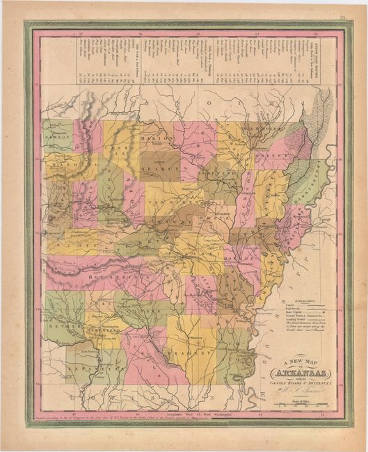
B. A New Map of Arkansas with Its Canals, Roads & Distances, dated 1841 (11.4 x 14.3"). Fine map showing early county configurations with good detail of cities, towns, roads, canals and railroads. County configuration is up to date as of 1840 with Bradley formed from Union and Yell from Pope, Scott and Hot Springs. A table at top displays the distances along various steamboat routes to and from Little Rock.
References:
Condition: B+
Original color with light soiling and toning along edges of sheet.