Subject: Mid-Atlantic United States
Period: 1850-55 (dated)
Publication:
Color: Hand Color
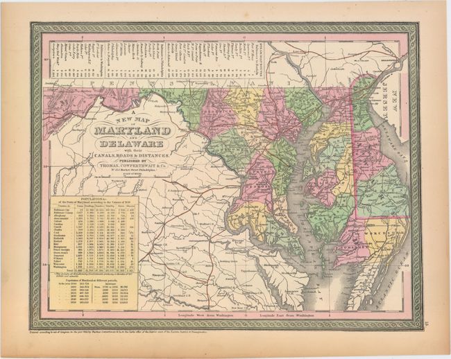
A. A New Map of Maryland and Delaware with Their Canals, Roads & Distances, by Thomas, Cowperthwait & Co., dated 1850 (14.7 x 11.5"). Attractive map with nice detail of the counties, cities, roads and railways. Table at top lists Steam Boat Routes - Baltimore to Norfolk, Baltimore to Philadelphia and Baltimore to Washington. An inset table lists the population according to the census of 1850 compared with earlier periods. Condition: Light toning confined to the sheet edges. (A)
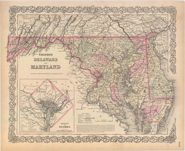
B. Colton's Delaware and Maryland, by G.W. & C.B. Colton & Co., dated 1855 (16.5 x 13.0"). Detailed state and county map with railroads, roads, canals, cites and villages. Inset of the District of Columbia identifies 12 locations on the grid plan. Surrounded by a scroll border. Condition: Minor soiling along the top portion of the map image and light toning confined to the sheet edges. (B+)
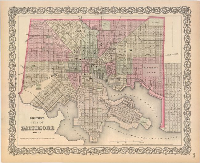
C. Colton's City of Baltimore Maryland, by G.W. & C.B. Colton & Co., dated 1855 (16.0 x 13.0"). Detailed map of the city's grid, divided into 20 wards. Identifies Patterson Park, Baltimore Cemetery, the Parade Ground and Fort McHenry. Surrounded by a scroll border. Condition: Light toning confined to the sheet edges. (A)
References:
Condition:
See description above.