Subject: Eastern United States
Period: 1828 (circa)
Publication:
Color: Hand Color
Size:
12.8 x 15.1 inches
32.5 x 38.4 cm
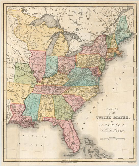
This handsome map includes all of the United States to the enlarged Arkansas Territory. Towns and cities, mountains, rivers, Indian tribes, and more are identified. Wisconsin and Minnesota are together called North West Tery., with Western Territory appearing farther west. Michigan Territory is shown as well as the relatively new states Alabama (admitted as a state in 1819), Maine (1820), and Missouri (1821). A sliver of Texas is referred to as Spanish Province of Texas. Published by Bennett & Walton.
References:
Condition: B
Issued folding with a few small areas of light toning. The folds have been reinforced on verso with Japanese tissue to repair several long fold separations. There are two tears that enter 3" and 4" into map at right that have been archivally repaired.