Subject: Eastern United States
Period: 1801 (dated)
Publication: Guthrie's New System of Geography
Color: Hand Color
Size:
18.1 x 15.7 inches
46 x 39.9 cm
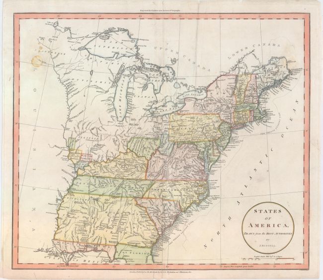
Guthrie first published this map circa 1785 as A Map of the United States of America Agreeable to the Peace of 1783, with continuing updated editions. This 1801 issue shows five divisions of land in southern Ohio named Seven Ranges, Army Lands, Ohio Company, Donation Lands from the Commonwealth of Virginia, and Col. Simmes. At the junction of the Ohio and Mississippi rivers can be found Illinois Company, Wabash Company, New Jersey Company, and Army Lands. South of the Ohio River, in present-day northern West Virginia, is a chunk of land named "Indiana" which rests just below the Seven Ranges. The Twenty Leagues Line is drawn in the coastal Atlantic. Kentucky and the Tennessee Government appear, and Georgia's boundary extends to the Mississippi River with numerous Indian tribes noted, primarily in the western portion. Maine lacks its northern tip. Lake Superior appears without its imaginary islands, Michigan is nearly blank with the name Utawas at its center, and several Indian tribes are located in the Wisconsin/Minnesota area, where little else is shown.
References:
Condition: B
There are a few stains at top left and right and some minor extraneous creases. There are professional repairs to a centerfold separation at bottom, a 2" tear to the east of the Carolinas, and a few small chips and tears confined to the blank margins.