Subject: Colonial Eastern United States
Period: 1754 (published)
Publication: Universal Magazine
Color: Hand Color
Size:
9.6 x 7.9 inches
24.4 x 20.1 cm
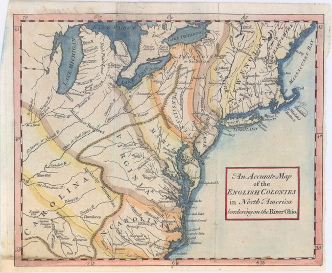
This unusual map of the colonies spans from the Carolinas north to the Great Lakes and Casco Bay off the coast of present-day Maine. It was published in the December 1754 issue of Universal Magazine, in the beginning months of the French and Indian War, which helps to explain the wishful configuration of the colonies. Although the coast is rendered with relative accuracy, the colonies appear in distorted form, extending farther to the north and to the west than is correct. South Carolina stretches farther north than the relatively small North Carolina, while Virginia, Maryland, and Pennsylvania push past the Appalachians and Ohio River into French territory. Cities and towns (among them Boston, Philadelphia, Jamestown, and Plymouth), rivers, Indian tribes, forts, and more are located, and Niagara Falls is shown with a note that it is a "160 foot" drop.
References: Jolly #UNIV-41; Sellers & Van Ee #707.
Condition: B+
Issued folding, now flat, with a few faint spots. The sheet has been remargined with old paper at bottom with a portion of the border replaced in facsimile.