Subject: Colonial Eastern United States & Canada
Period: 1717 (circa)
Publication:
Color: Hand Color
Size:
10.2 x 7.2 inches
25.9 x 18.3 cm
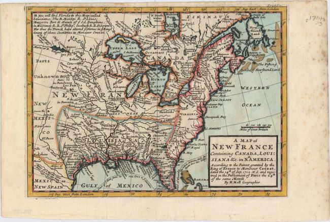
This interesting map depicts the French possessions in North America in the early part of the eighteenth century. New France included Canada and the proprietary colony of Louisiana, which included the former Spanish possessions in Florida. In 1712, King Louis XIV selected Antoine Crozat, the Marquis de Chatel, as the proprietor for Louisiana. Crozat was granted a monopoly on trade for fifteen years, but failed to develop the colony and relinquished his rights in 1717. The map is filled with information including colonial settlements, Indian villages, and forts. The British colonies are confined east of the Appalachian Mountains. The Great Lakes are presented in a strange format and La Hontan's R. Longue is shown in the upper left. The route of the Spanish treasure fleet is shown in the Gulf of Mexico and around the tip of Florida. Published in London in Thomas Salmon's Modern History: or the Present State of All Nations.
References: McCorkle #717-1.
Condition: A
A superb impression on watermarked paper with scattered foxing confined to the blank margins.