Catalog Archive
Auction 151, Lot 103

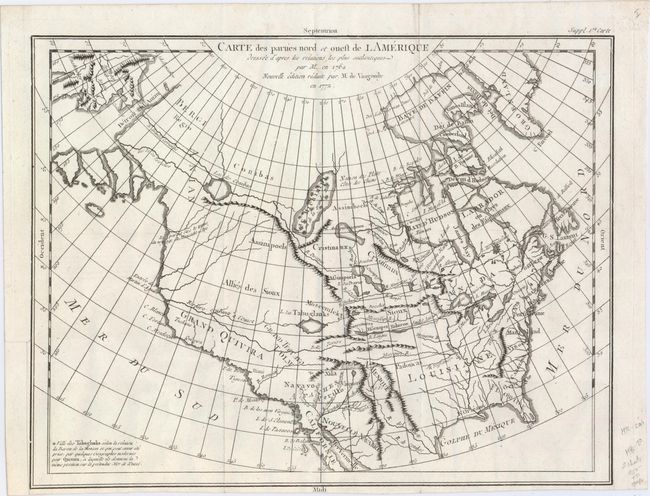
"Carte des Parties Nord et Ouest de l'Amerique Dressee d'Apres les Relations les Plus Authentiques par M... en 1764", Robert de Vaugondy, Didier

Subject: Colonial United States & Canada

Period: 1772 (dated)

Publication: Diderot's Encyclopedia (Supplement)

Color: Black & White

Size:
15.2 x 11.8 inches
38.6 x 30 cm
Download High Resolution Image
(or just click on image to launch the Zoom viewer)

The Encyclopedie was published under the direction of Diderot from 1751 onward with thousands of articles written by the most prominent philosophers and scientists of the time. These great minds collaborated in the goal of assembling and disseminating the fruits of accumulated knowledge and learning. This massive reference work for the arts and sciences, served to propagate Enlightened ideas. Read a full description of this work and Diderot at Wikipedia.com.

Robert de Vaugondy's rendition of Samuel Engel's map of 1764 alters the North American coastline slightly and extends to include part of Asia. The myth of a Northwest Passage continues to persist, here linking the Detroit d Anian with Lac Michinipi by a system of rivers and a large Lac des Conibas. There is also a River of the West that connects to another large lake, L. des Tahuglanuks that is located near a remnant of Lanhotan's R. Longue. Alaska is shown as a series of large islands. California is labeled Grand Quivira. A great map that illustrates many of the cartographic myths of the period.

References: Pedley #453; Portinaro & Knirsch #158.

Condition: A

A clean and bright example with a dark impression on watermarked paper and a couple of minute worm holes. Issued folding with a binding trim at left that has been replaced with old paper. Narrow bottom margin.

Estimate: $200 - $230

Sold for: $110

Closed on 11/19/2014

Archived