Subject: St. Lawrence Bay & River, Canada
Period: 1757-80 (circa)
Publication: L'Histoire Generale des Voyages...
Color: Hand Color
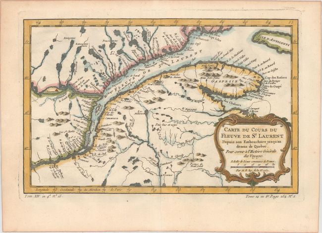
A. Carte du Cours du Fleuve de St. Laurent Depuis son Embouchure Jusqu'au Dessus de Quebec..., dated 1757 (11.9 x 7.6"). Nice example of the second state of this copper engraved map, published by La Harpe circa 1780-86. The map details the course of the St. Lawrence River from Anticosti Island and the mouth west to beyond Quebec. It details many rocks and shoals in the river with numerous villages and forts located along the shore. Decorated with a rococo-style cartouche that includes a distance scale.
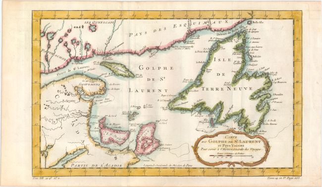
B. Carte du Golphe de St. Laurent et Pays Voisins pour Servir a l'Histoire Generale des Voyages, circa 1780 (14.2 x 8.7"). This attractive, copper engraved map shows St. Lawrence Bay with Anticosti Island, Prince Edward Island (I. St Jean), Cape Breton Island (Isle Royale), Newfoundland and the adjacent mainland. The map is adorned with a decorative rococo-style cartouche. This is the second state, with "Tome 14. In 8o. Page 263" engraved at bottom right, outside of neatline. Published by La Harpe.
References: Kershaw #590 & #627.
Condition: A
Clean and bright examples on watermarked paper with nice impressions. The map of St. Lawrence Bay is issued folding with minor offsetting.