Catalog Archive
Auction 150, Lot 82

"Americque Septentrionale par le Sr. Sanson d'Abbeville Geographe du Roy", Sanson/Mariette

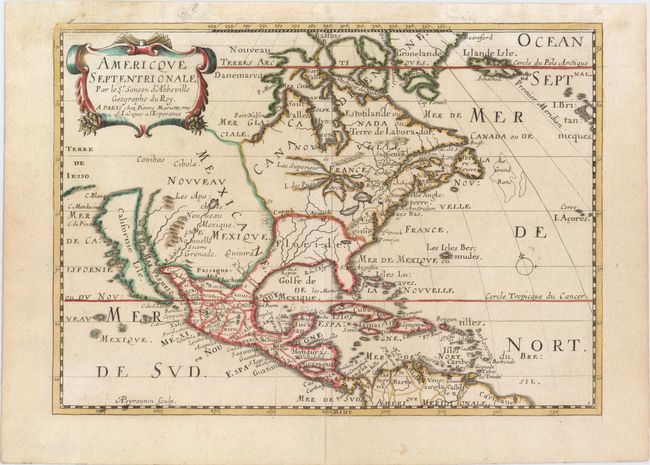
Subject: Colonial North America

Period: 1667 (circa)

Publication: L'Amerique en Plusieurs Cartes Nouvelles

Color: Hand Color

Size:
11.1 x 7.9 inches
28.2 x 20.1 cm
Download High Resolution Image
(or just click on image to launch the Zoom viewer)

This is a reduced and revised version of Sanson's important map of North America (1650). The map was originally engraved by A. Peyrounin in 1657 and there were several editions. This edition has been updated with a number of significant improvements. It still shows California as an island with a nearly flat northern coast, as well as a coastline of Terre de Iesso to the west. All five Great Lakes are shown, with Lake Erie unnamed and Lakes Superior and Michigan open-ended to the west. The Rio Grande River (R. de Nort) drains into the Gulf of California from a large interior lake in the country of Les Apaches, which dominate Nouveau Mexique. The British colonies are shown simply as Nouvelle Angleterre and Virginie. Engraved by A. Peyrounin. This is the third state.

For more information on the partnership between Nicolas Sanson and Pierre Mariette, click here to read the article from our August 2014 Newsletter.

References: Burden #324; McLaughlin #18; Pastoureau, SANSON II C.

Condition: A

A nice impression on watermarked paper with professional repairs to a centerfold separation that enters 1/2" into map at bottom and several small chips in top blank margin.

Estimate: $750 - $900

Sold for: $450

Closed on 9/17/2014

Archived