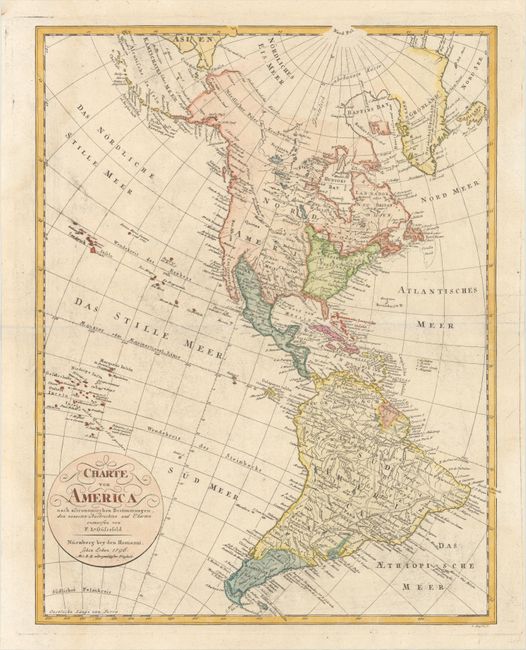
Subject: Western Hemisphere - America
Period: 1796 (dated)
Publication:
Color: Hand Color
Size:
17.7 x 22.7 inches
45 x 57.7 cm
This uncommon German map of the Americas features unusual mountain ranges throughout both North and South America. The United States is confined to the east of the Mississippi. Florida is a separate territory, as are the vaguely defined Louisiana and Neu Mexico. The boundaries in the west, between Canada and Mexico, are not delineated, and the unexplored regions are left blank. The West or Oregon River is shown with dotted lines indicating two possible entry points into the Pacific. Beneath the Oregon River is the mythical Quivira. Northern California is called Neu Albion. The Hawaiian Islands are shown as the Sandwich Inseln with phonetic spelling for the individual island names. Between Hawaii and California there is an erroneous group of islands with Spanish names. These islands were introduced on maps in the mid-18th century and were not corrected until the early 19th century. The South American continent is very well mapped and filled with detail. Parima, the legendary lake, is depicted.
References:
Condition: B+
On a watermarked sheet with a faint dampstain along the left border and light printer's ink residue.