Subject: Atlases
Period: 1885-1909 (published)
Publication:
Color: Printed Color
George Franklin Cram was a civil war veteran who marched with Sherman prior to his career as a map publisher. In 1867, George F. Cram and his uncle, Rufus Blanchard, founded the company Blanchard & Cram in Evanston, IL. The company manufactured and sold maps and atlases. Cram became the sole owner two years later and renamed it the George F. Cram Company. They sold a wide variety of atlases including the popular Unrivaled Atlas of the World which was printed continuously from the 1880s to 1952. In 1921, George Cram sold his business to one of his largest customers, E.A. Peterson of the National Map Company. The company is to this day producing quality maps and globes.
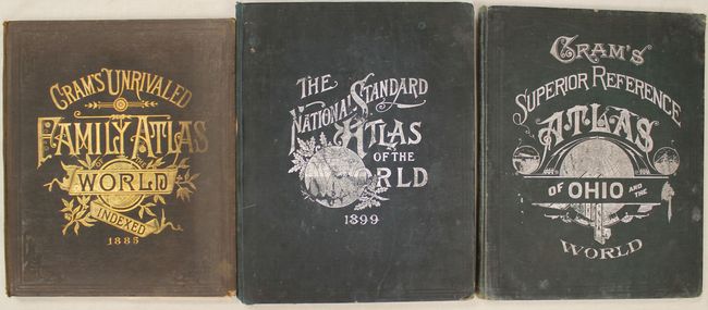
A. Cram's Unrivaled Family Atlas of the World, published 1885 (11.8 x 14.0"). This atlas consists of 76 out of 79 wax engraved maps which are tipped-in with fancy borders. The missing maps are Illinois, Michigan and Wisconsin. Charts include Flags of the World, types of the Races of Men, as well as other thematic charts and pages of portraits. This edition was originally published in 1883 with a revised copyright date of September 1885. Title page, contents, list of the population of cities, index, 200 pp. Hardbound in original brown cloth with embossing and gilt titling on the cover. Condition: Covers have separated from text block and pages are loose. (B)
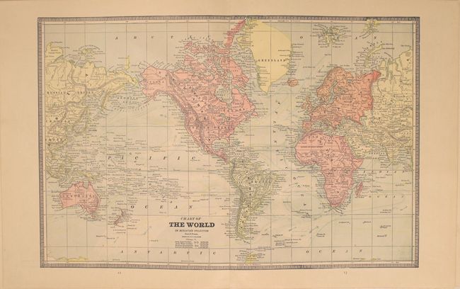
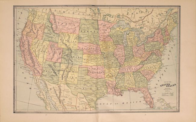
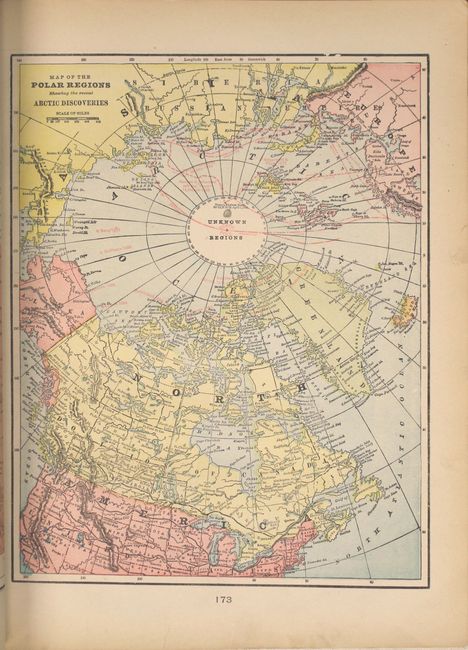
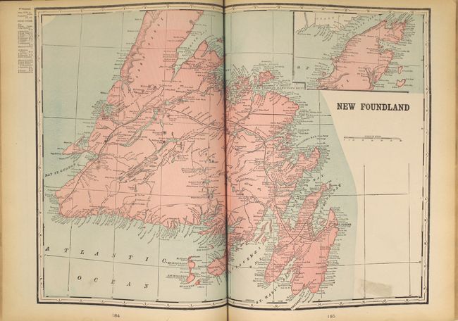
B. The National Standard Family and Business Atlas of the World Specially Adapted for Commercial and Library Reference..., published 1899 (11.7 x 14.9"). This complete atlas contains 29 double-page, and 82 single-page cerographic maps of the world and continents. It is nicely illustrated with dozens of wood engraved vignettes, state seals, charts, diagrams and colorful examples of the Flags of the Various Nations and the Arms of Various Nations. The Map of the Polar Regions... shows the more recent expeditions to the North Pole by explorers like McClintock, Berry, Collinson and others stamped in red ink. An interesting double-page map of Newfoundland shows little interior detail, but does include the island's telegraph lines and stations. The route of the Newfoundland Railroad, featured prominently on this map, runs from Port Aux Basques, eastward to St. Johns. In the back of the atlas is a 20-page chronology of ancient, medieval and modern history, and an exhaustive 105-page index. Published by the Fort Dearborn Publishing Co. Small folio with 420 pages. Hardbound in original green cloth with silver titling on front cover. Condition: Covers are nearly detached. (B+)
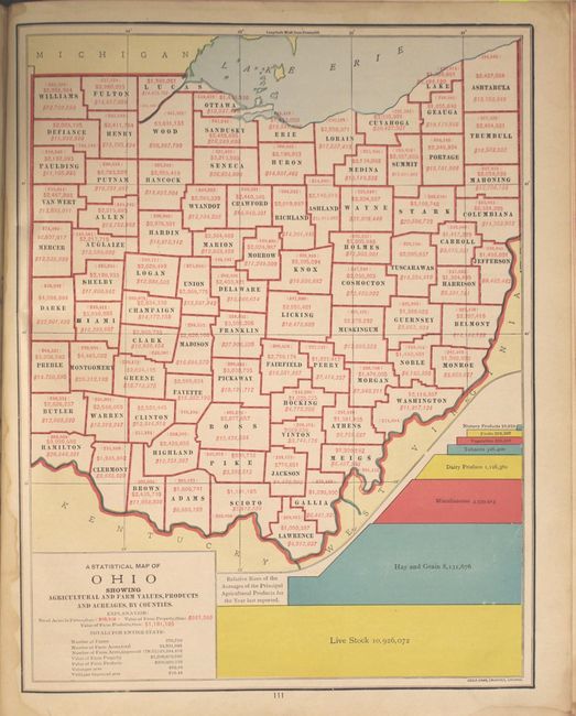
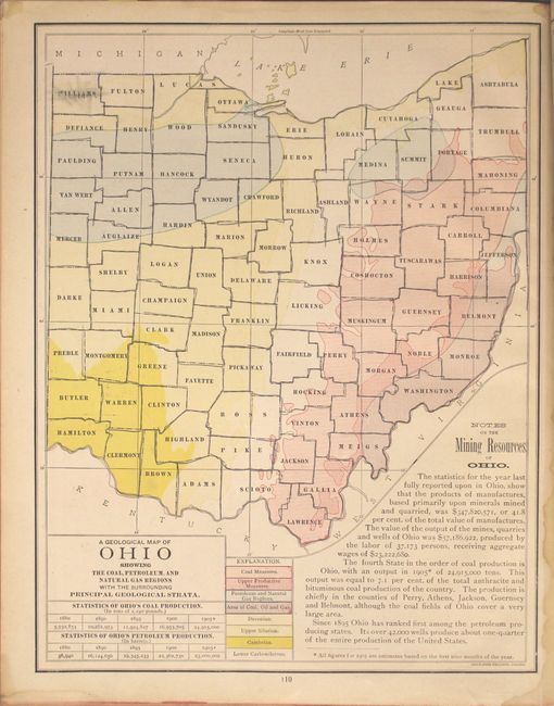
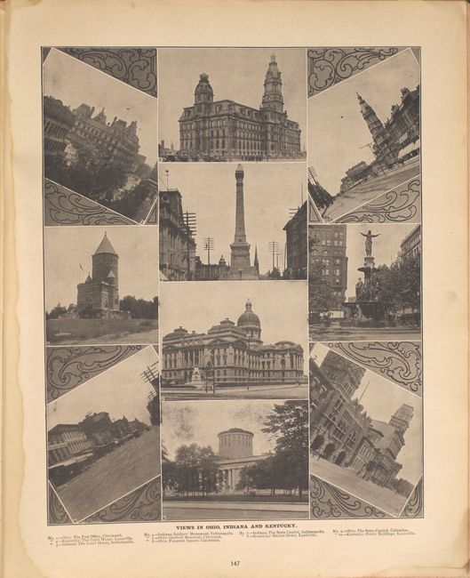
C. Cram's Superior Reference Atlas of Ohio and the World, published 1909 (12.0 x 15.0"). This uncommon atlas contains 44 double-page, 22 single-page, and 12 quarter-page cerographic maps of the world and continents. There are seven maps of Ohio depicting the geology, agriculture, mining and industry of the state. The atlas also features detailed plans of Cleveland, Cincinnati, Columbus and Toledo, and a 15-page index of Ohio. Extensively illustrated, this example includes a series of attractive black and white photographs showing scenes of faraway places like Greenland, the Philippines and Europe. The atlas is further illustrated with three pages of presidential portraits, the Flags of the Various Nations and the Arms of Various Nations. An interesting map of the North Polar Regions… shows the tracks of 20 explorers, including Cook, Peary, Baffin and Hudson. Small folio with 168 pages. Hardbound in original green cloth with decorative silver titling on front. Condition: The covers are stained and nearly detached. Pages 125-126 are missing while pages 129-132 are present but loose, and several pages of illustrations at the back are partially torn. (B)
References:
Condition:
The maps are in good to very good condition with occasional soiling, pencil marks and edge tears. See description above for additional details.