Subject: Western Hemisphere - America
Period: 1786 (dated)
Publication:
Color: Hand Color
Size:
21.2 x 19.6 inches
53.8 x 49.8 cm
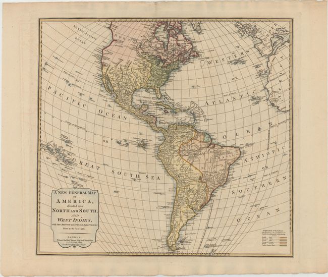
This is a very uncommon map of the Americas by one of the most prominent English cartographers of the late 18th century. The focus of the map is on the political boundaries and colonial possessions in the Western Hemisphere. A colored key at bottom right identifies the possessions of the English, Spanish, French, Portuguese, Dutch, and the new United States. The United States extends to the Mississippi River with the borders of the states left open-ended towards the west, while the Spanish maintain possession of Florida and the Southwest. A dotted line in the Pacific Northwest denotes the River of the West, connecting to St. Charles River of the South and then to a series of lakes and rivers through to Hudsons Bay. There is good detail of rivers and mountains with short notations throughout. The mythical lakes Parima L. and L. of Xareyes still appear in South America, but are greatly reduced in size.
References:
Condition: B+
Attractive color on watermarked paper with wide margins, light offsetting, and minor soiling.