Subject: East Indies - Indonesia
Period: 1739 (circa)
Publication: Salmon's Modern History
Color: Hand Color
Size:
10.3 x 7.8 inches
26.2 x 19.8 cm
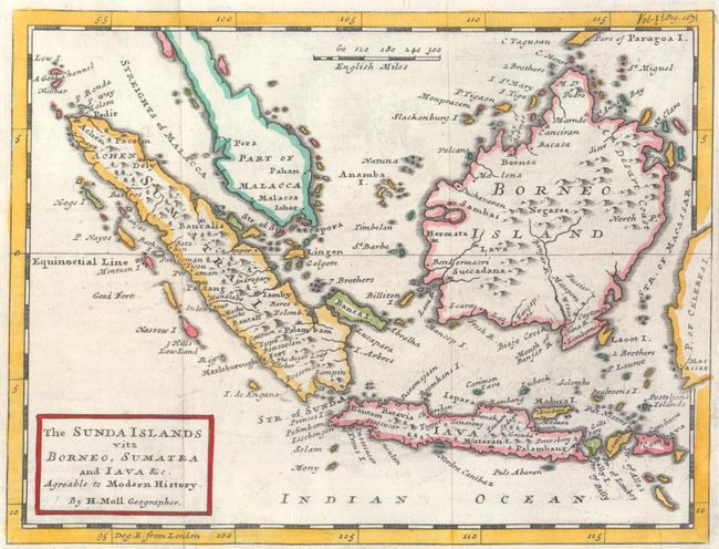
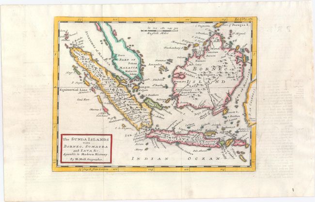
This handsome chart, done in Moll's distinctive engraving style, covers the western portion of the East Indies to include Sumatra, Borneo, Java, and the southern portion of the Malaysian peninsula. In Sumatra the map locates the Aceh region (Achen), Palembang (Palambam), Batahan, Padang, and the famous textile center of Bandar Lampung (Iampin). In Java, Jakarta is Batavia and Palembang is erroneously added in the east. Stretches to include Bali, Lambok, Sumbawa, and part of the Celebes, which extends off the map into the border. The Straits of Sincapora (Singapore), and the Malacca are named. Distance scale of English Miles.
References: McCorkle (18th C. Geography Books) #347-7; cf. Shirley (BL Atlases) G.SALM-1a #5.
Condition: A
Issued folding, now flat, on a watermarked sheet with good margins and minor offsetting.