Subject: Myanmar, Thailand
Period: 1775 (circa)
Publication: Le Neptune Oriental
Color: Black & White
Size:
19.1 x 13.3 inches
48.5 x 33.8 cm
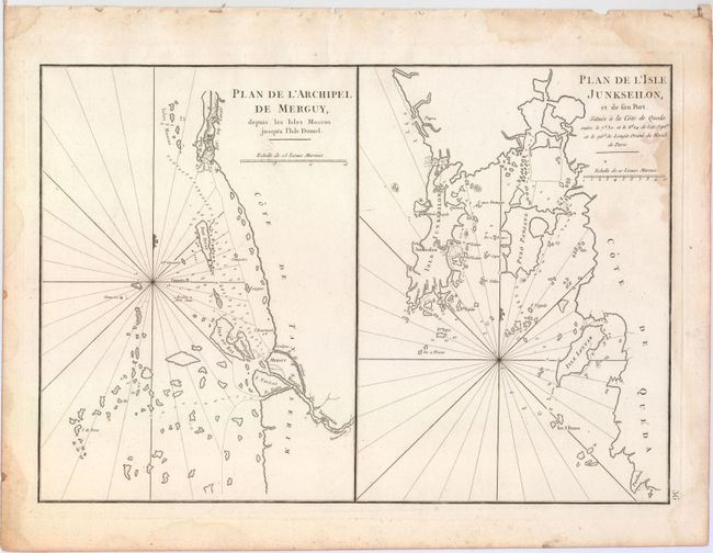
This sheet features two striking charts of the Malay Peninsula and Andaman Sea and includes rhumb lines, soundings, hazards, and a plethora of tiny islands. The chart on the left shows part of the Mergui Archipelago, a cluster of over 800 small islands located off the southern coast of Myanmar (Burma) in the Andaman Sea. Kadan Kyun (Isle du Roy), the largest island of the archipelago, appears near the chart's center. The second chart focuses on the southwest coast of Thailand, depicting Phuket (Junkseilon) and neighboring provinces and islands.
A French sailor and hydrographer, D' Après de Mannevillette (1707-1780) used new instruments to correct the latitudes measured by previous explorers. His atlas Le Neptune Oriental, first published in 1745, was considered a major achievement and an indispensable resource for navigators.
References: Shirley (BL Atlases) M.APR-1c.
Condition: B+
On a sturdy, watermarked sheet with light damp stains along the edges, one of which enters into image at top right, and some faint soiling.