Subject: Central Asia
Period: 1730 (circa)
Publication: Claudii Ptolemaei's Atlas Tabulae Geographicae Orbis Terrarum
Color: Hand Color
Size:
17.9 x 13.3 inches
45.5 x 33.8 cm
Claudius Ptolemy was a mathematician, astronomer and geographer who worked in Alexandria, then a part of the Roman Empire, in the 2nd century AD. One of the most learned and influential men of his time, his theories dominated both astronomy and geography for nearly 1500 years. His writings were kept alive by Arabic scholars during the Middle Ages and reemerged in Europe during the Renaissance. The birth of printing led to wide dissemination of his great works on astronomy and geography. There were a number of editions of his Geographia beginning in 1477. These early editions contained maps based on his original writings, known as Ptolemaic maps. As geographic knowledge increased with the explorations of Columbus, Magellan, Cabot and others, maps of the New World were added, and maps of the Old World were revised. Ptolemy's Geographia continued to be revised and published by some of the most important cartographers including Martin Waldseemuller, Sebastian Munster, Giacomo Gastaldi, Jodocus Hondius, and Gerard Mercator (whose last edition was published in 1730).
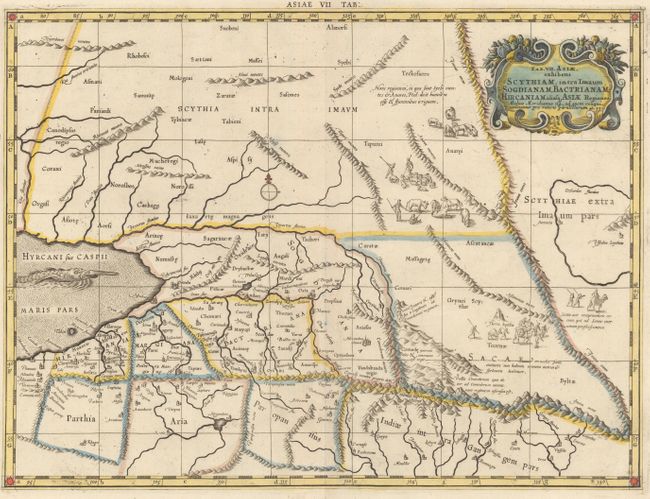
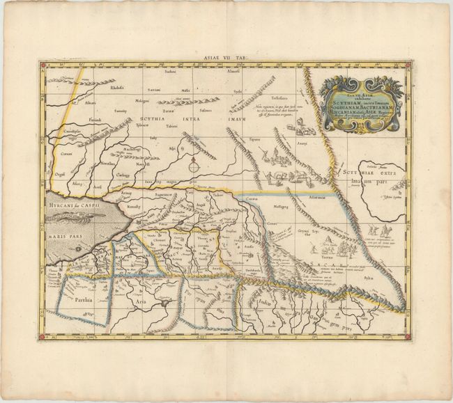
This fine copper engraved map covers Central Asia east of the Caspian Sea and what is now Turkestan, the Steppes, Afghanistan and beyond. The Himalayas and Northern India run across the bottom of the map. Mercator originally published this map in his 1578 edition of Ptolemy's great Geography. Although he is most renowned today for the projection he popularized and for first using the term Atlas for a collection of maps, he devoted much of his life to his Ptolemaic maps. The maps were beautifully engraved as nearly as possible to their original form and embellished with fine cartouches and cultural scenes. This map includes scenes of shepherds and their flocks and a great sea monster.
References: Mickwitz & Miekkavaara #235-13; Van der Krogt (Vol. I) #0927:1.3.
Condition: A
A fine impression with attractive color, wide margins, and a few spots of printer's ink residue. There is a damp stain on the bottom edge of the sheet, far from map image.