Subject: Russia
Period: 1750 (dated)
Publication: Atlas Universel
Color: Hand Color
Size:
23.3 x 18.7 inches
59.2 x 47.5 cm
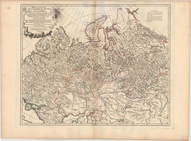
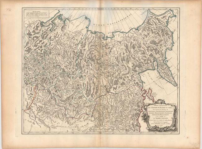
A pair of large, finely engraved maps that cover the entire Russian Empire. Size varies slightly.
The first map shows the western part of the Russian Empire extending from Poland, and east to Irkurkoy, Ilimskoy, and the R. Tunguska, and south to include part of the Black and Caspian seas. The map provides topographical details, watershed, forests, and cities. The decorative title cartouche features a trio of wind heads and two bears. This map was done by Didier Robert de Vaugondy.
The second map describes the region from Tomsk eastward to include the Kamchatka and Sakhalin. Decorative rococo-style title cartouche fills the lower corner. This map was done by Gilles Robert de Vaugondy.
References: Pedley #404 & #405.
Condition: B+
Both are on watermarked paper with toning along the centerfolds and light color offsetting. The bluish hue that appears in the scanned images is a result of the scanning process and is not present on the actual sheets.