Subject: Scandinavia
Period: 1752 (circa)
Publication: The Universal Traveller
Color: Black & White
Size:
10.9 x 12.8 inches
27.7 x 32.5 cm
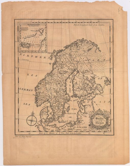
This striking map of Scandinavia extends to show parts of Russia, Poland, and Germany. There is good topographical detail within Scandinavia, and many towns, political divisions, and rivers are identified. An inset in the top left corner shows the Norwegian Sea with Greenland and Iceland. The map is adorned with a beautiful title cartouche and a compass rose capped with a fleur-de-lis. Engraved by John Gibson.
References: McCorkle (18th C. Geography Books) #375-25.
Condition: B
A dark impression issued folding on evenly toned, watermarked paper with light offsetting and a few fold separations confined to the blank margins closed on verso with archival tape.