Subject: London, England
Period: 1755 (dated)
Publication: Maitland's History and Survey of London
Color: Hand Color
Size:
18 x 14 inches
45.7 x 35.6 cm
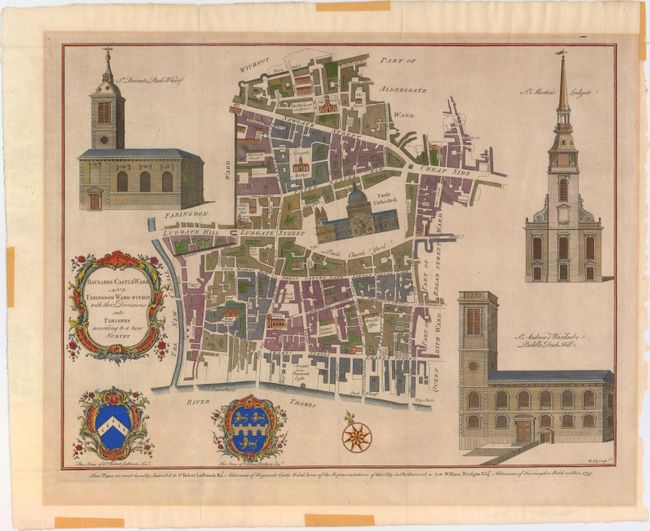
These copperplate engravings were published in William Maitland's History and Survey of London, 1756. They are very detailed maps of the streets, lanes, alleys and courts in the ancient city of London. They are richly embellished with architectural profiles of major churches or important buildings, the arms of the mayor and aldermen, elaborate title cartouches and compass roses.
Decorative and detailed plan of central London with St. Paul’s Cathedral at center. Surrounded by vignettes of the churches at St. Andrew's Wardrobe, St. Martin's Ludgate, and St. Bennets Pauls Wharf. Includes the coats of arms of Sir Robert Ladbrook Knt and William Bridgen Esq at bottom.
References: Potter, p. 90 (illustrated).
Condition: B+
Issued folding on watermarked paper with light toning and remnants of masking tape in the blank margins, far from map image.