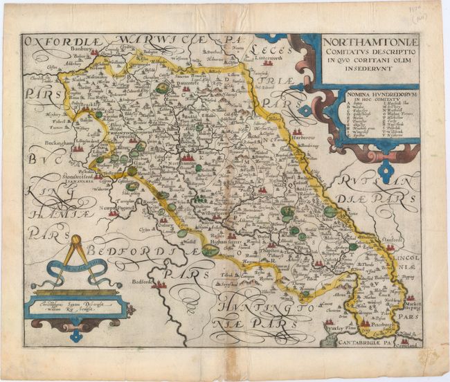
Subject: Northamptonshire, England
Period: 1610 (circa)
Publication: Camden's Britannia
Color: Hand Color
Size:
14.1 x 11.1 inches
35.8 x 28.2 cm
This is an early map of the county of Northamptonshire engraved by William Kip and based upon the famous survey by Christopher Saxton. It is fully engraved to illustrate all the salient features of the county including market towns, rivers, castles, forests, parks, hills, and bridges. Parts of several surrounding counties are shown as well. The map is further decorated with strapwork title and scale cartouches, with the names of the county's hundreds in a key beneath the title. North is oriented to the right.
References:
Condition: B+
On a watermarked sheet with light toning along the centerfold and light printer's ink residue. There is a short centerfold separation at bottom that just enters the map image, and a short one at top confined to the blank margin.