Subject: British Islands
Period: 1676 (published)
Publication: Theatre of the Empire of Great Britaine
Color: Black & White
Size:
20 x 15 inches
50.8 x 38.1 cm
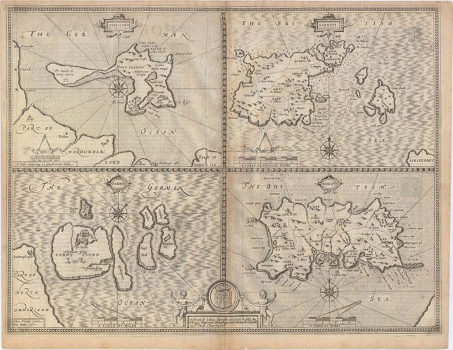
This folio sheet has four maps finely engraved by Jodocus Hondius for Speed in 1610 as noted in the imprint at lower left. The islands of Holy Island and Farne (Lindisfarne), off the Northumberland coast are shown at left, and at right are Guernsey and Jersey. The islands are described in English text on verso. Each map is embellished with a compass rose, title and scale cartouche. At the bottom, the cartouche includes the coat of arms with two cherubs and the imprint of Bassett and Chiswell indicating it was published in 1676. English text on verso.
References: Shirley (BL Atlases) T.SPE-1k #68.1-68.4.
Condition: B+
Light toning along the centerfold with a separation at bottom that just touches the neatline and a few small spots. Faint text show-through.