Catalog Archive
Auction 150, Lot 395

"A New & Accurate Chart of the Western or Atlantic Ocean Drawn from Surveys and Most Approved Maps & Charts. The Whole Being Regulated by Astronomical Observations", Bowen, Emanuel

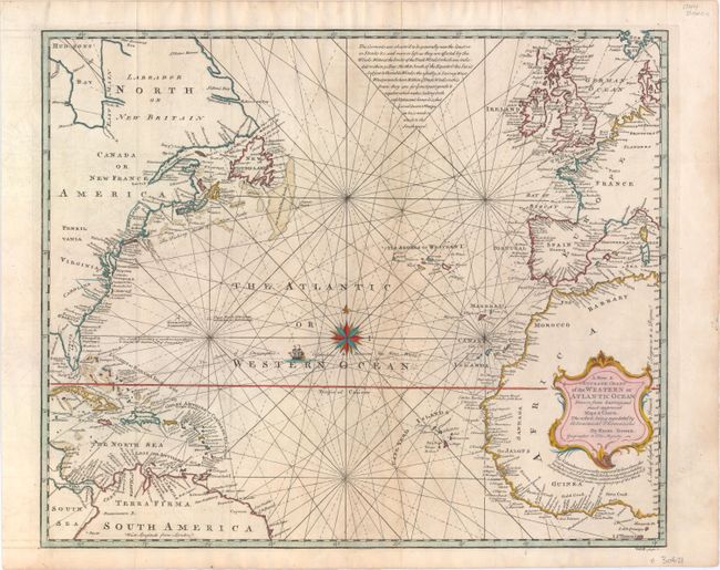
Subject: North Atlantic

Period: 1744 (circa)

Publication: John Harris' Navigantum Atque…

Color: Hand Color

Size:
17.5 x 14.5 inches
44.5 x 36.8 cm
Download High Resolution Image
(or just click on image to launch the Zoom viewer)

A handsome map centered on the Atlantic. It includes small parts of South America, the Caribee Islands, the coast of North America, western Africa, and Europe. Christopher Columbus' route is graphically depicted with a ship. There are several interesting notations including South Carolina's boundary according to King Charles' Charter in 1665, and another disputing Columbus' discovery of the New World, noting the possibility that Madoc, a Prince of North Wales sailed to the coast of Florida in 1170.

References: Shirley (BL Atlases) G.HARR-1a #16.

Condition: B+

Issued folding on watermarked paper with minor offsetting and light soiling.

Estimate: $475 - $600

Unsold

Closed on 9/17/2014

Archived