Subject: Lima & Paita, Peru
Period: 1755-63 (circa)
Publication:
Color: Hand Color
A. Piano Scenografico della Citta dei Re, o Sia di Lima Capitale del Regno del Peru…, by Veremondo Rossi, circa 1763 (10.7 x 10.2"). This is a very detailed view of the fortified city of Lima. The river protects one side and extensive ramparts and suburbs surround the other sides. Across the top the legend lists and keys 70 buildings and important features within the city and vicinity. Drawn by Veremondo Rossi with no attribution given for the engraver. A beautifully engraved and scarce Italian-produced map. Condition: Ample margins with light toning along the centerfold and sparse scattered foxing, mostly confined to the blank margins. An edge tear in top blank margin has been repaired on verso with archival tape. (B+)
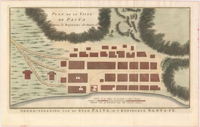
B. Plan de la Ville de Paita dans le Royaume de Santa Fe / Grond-Tekening van de Stad Paita, in 't Koningryk Santa-Fe, by J. Van Schley, circa 1755 (14 x 7.9"). This bird's-eye plan of the town of Paita shows a basic block city plan with several roads leading out of the town. Paita was an important Spanish seaport city in northern Peru during the 16th century. In 1741, George Anson landed in Paita and sacked the city during his voyage around the world. The dotted line between "A" and "B" shows the movements of Anson's crew through the town. This plan first appeared in Richard Walter's A Voyage Around the World, and was later re-engraved by van Schley for a Dutch edition of Prevost's Histoire Generale des Voyages. Condition: Issued folding on watermarked paper. (A)
References:
Condition:
See description above.