Subject: Venezuela
Period: 1633 (published)
Publication: Gerardi Mercatoris et I. Hondii Atlas
Color: Hand Color
Size:
19.3 x 14.8 inches
49 x 37.6 cm
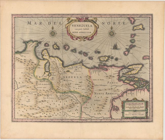
Beautifully engraved map based on the cartography of Hessel Gerritsz covering the northern coast of South America, Venezuela, east to the mouth of the Orinoco, and including the offshore islands from Aruba through Dominica and Tobago. The fine engraving illustrates the mountains, forests, rivers and indigenous animals but shows place names primarily along the coastlines owing to the relatively few explorations made into the interior. The map is richly embellished with title and distance scale cartouches, compass roses and a galleon. Engraved by Evert Symonsz Hamersveldt and S. Rogeri. French text on verso.
References: Van der Krogt (Vol. I) #9830:1.1.
Condition: A
Original color on watermarked paper with wide margins and light printer's ink residue.