Subject: Colombia & Panama
Period: 1690 (circa)
Publication: The English Pilot
Color: Hand Color
Size:
21.4 x 17.6 inches
54.4 x 44.7 cm
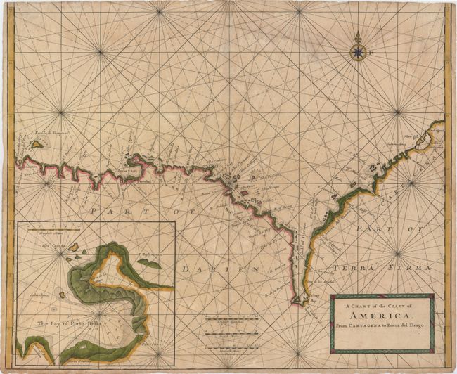
This chart depicts the coastline from Cartagena, Columbia to west of Portobelo, Panama. There is good detail of rocks, shoals, islands, and anchorages off the shore. Rivers, bays, points, and ports are named all along the coast. A large inset shows the bay of Portobelo, protected by two forts: Forta de la Mare and Forta Granda.
The map is a collaborative effort by Jeremiah Seller and Charles Price. Jeremiah, John Seller's son, apprenticed under his father and was a mapmaker, instrument-maker and publisher. He formed a partnership with Price, another young mapmaker, and became "Hydrographers to ye Queen" and "Compass makers to the Navy Royall." In about 1705, complaints over the quality of their instruments caused Seller and Price to lose their contract with the Admiralty and the firm was forced into bankruptcy. Thus their maps are rare in today's market. We can find no sales records for this map for the past 35 years, and only one example appears to exist in library collections, at the Newberry Library.
References:
Condition: C+
A nice impression with light toning and soiling, a faint damp stain at top right, and a few edge tears 1.5" or less in length, all of which have been archivally repaired. Trimmed at top with complete loss of neatline.