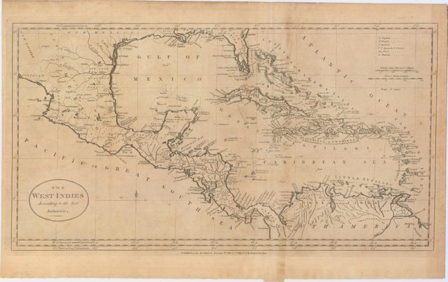
Subject: Gulf of Mexico and Caribbean
Period: 1785 (dated)
Publication:
Color: Black & White
Size:
20.8 x 11.2 inches
52.8 x 28.4 cm
This early map of the Caribbean provides excellent detail on the islands to include northern South America, all of Central America and most of Mexico. Extends to show the delta of the Mississippi River. Florida is East Florida and the southern portion is oddly shaped with numerous waterways slicing the peninsula into many islands. The region of Texas is labeled New Mexico. With a simple oval title cartouche. Legend at upper right was to indicate colonial possession, but remains uncolored in this edition. Published by Charles Dilly and G. Robinson on January 1, 1785.
References:
Condition: B+
Issued folding with light toning along the folds and faint scattered foxing.