Subject: Gulf of Mexico and Caribbean
Period: 1740 (dated)
Publication:
Color: Hand Color
Size:
36.4 x 19.4 inches
92.5 x 49.3 cm
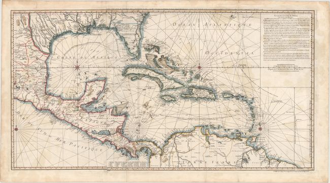
This is a very scarce chart of the Gulf of Mexico drawn from Popple's important map of the British Empire in America with "corrections and augmentations" as noted by Buache in the French text at upper right. The chart is focused on navigational information, with soundings, shoals, currents, etc. carefully noted. It extends to include much information on the interior of northern South America, Central America, and the southern U.S. The pattern of the trade winds is traced. Cenis appears with a corresponding note that reads, "Mission de los Teijas etablie en 1716." A key at bottom identifies 30 sites of interest in Panama. On two sheets joined.
References: Lowery p. 278, #358.
Condition: B
On sturdy watermarked paper with light scattered stains, minor offsetting, and several archivally repaired fold separations, only one of which enters 2" into map image at bottom.