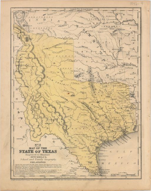
Subject: Texas
Period: 1846 (dated)
Publication: Mitchell's School and Family Geography
Color: Hand Color
Size:
8 x 10.5 inches
20.3 x 26.7 cm
This map features the "stovepipe" configuration showing Texas at its largest extent when first admitted to the Union. It shows the western boundary at the Rio Grande del Norte, putting Santa Fe in Texas. Part of Texas continues to the northwest above Taos in an area labeled the Green Mountains. This edition is the first to name Dallas. There are no counties formed west of about 98°, but there is a large unorganized Bexar region above San Antonio de Bexar and below a region labeled Wild Horses. In the western region a number of Indian tribes are named. This is the most desirable map of Texas from the Mitchell school geographies.
References:
Condition: B+
Minor soiling primarily in the blank margins and a few small spots.