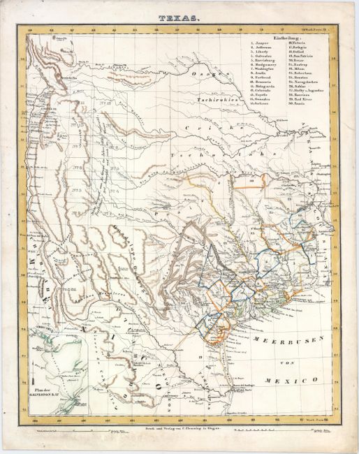
Subject: Texas
Period: 1845 (circa)
Publication:
Color: Hand Color
Size:
12.5 x 15.5 inches
31.8 x 39.4 cm
This German map is a reduced version of Arrowsmith's 1841 Republic of Texas map showing the full extent of Texas's claims to the region of the upper Rio Grande, including Santa Fe, Taos and Albuquerque. The detailed map shows many roads, rivers, towns, and forts. Thirty land districts are outlined and named in a table at the top right corner. The northern panhandle is divided into 12 sections, with the notation (copied from Arrowsmith) that the land was well wooded and watered. Small inset of Galveston Bay.
References:
Condition: A
A bright, clean example with a minor damp stain in the bottom margin and an edge tear confined to the right blank margin closed on verso with archival tape.